

Use the "back" button of your browser to return to the list of abstracts.
A GEO-TREKKING GUIDE TO AN ETHIOPIAN TROPICAL MOUNTAIN DISTRICT [Abstract ID: 1212-08]
In order to reach all persons interested in geosites and human-environment interactions in Ethiopia’s tropical mountains, we prepared a geoguide about the Dogu’a Tembien district in Tigray, Ethiopia, a mountain district with a varied geography and spectacular landscapes. Since we are a large team conducting research in that district and local people tell that we know not only every footpath but even every stone on those footpaths, we prepared it as a geo-trekking guide (published by Springer).
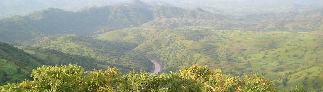
Dogu’a Tembien (13°39’N, 39°11’E, approx. 1000 km²) was selected as a representative district and mountain massif (up to 2850 m high) in the Northern Ethiopian Highlands, as it is easily accessible, presents scenic landscapes, and holds almost all geological formations, and associated landforms, occurring in Ethiopia. The subhorizontal structural landscape of scarps, ledges and mesas, resulting from the differential erosion resistance of the various lithologies is locally described as “imba” landscape, or “amba” in Amharic.
After deforestation, which took place over the last 4000 years, topsoil and subsoil disappeared in many places, predominantly by water and tillage erosion, as well as by landsliding. Presently, there is an active policy to reforest steep slopes and to apply various soil and water conservation measures.
Around 150 scientific publications addressing various environmental and social aspects of this district were used to prepare the Geo-Trekking Guide, whose objectives are:
- to illustrate the geodiversity of Dogu’a Tembien by providing an overview and descriptions of geosites;
- to convey all research results on geomorphological processes, geology, hydrology, vegetation, human-environment interactions, rural sociology, land management, and soil and water conservation, to a broader public;
- to popularise the large effort that is done on environmental management to the broader public;
- to indicate the exact field locations of, and (foot) access to the geosites by Ethiopian residents and visitors;
- to provide concise and site-specific information for scientific and students’ excursions;
- to enhance and promote geoheritage and geotourism; and
- to enhance sustainable trekking tourism in Dogu’a Tembien and Ethiopia.